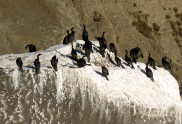
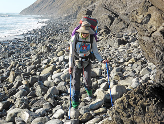
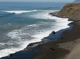
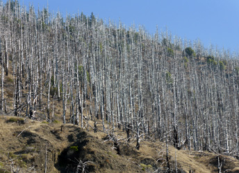
California's Lost Coast Trail lies south of Eureka/Arcata and north of Fort Bragg, in the King Range National Conservation Area. It is a nearly untouched coast, just for hikers. The 24 mi hike goes along the shore or nearby on bluffs. It is not a trivial hike. The main challenge are several coastal sections which are impassable at high tide. This implies a careful hiking schedule. Other experiences are hiking on rolling rocks and deep soft sand. Stream crossings are not problematic. Dogs are allowed but can become a liability. There is no cell phone connection to call for help. Since one hikes close to steep cliffs there is a remote probability of disappearance by tsunamis or rock/mud slides. The weather can change each day, fog is common.
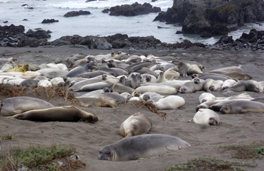
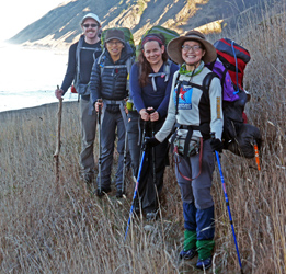
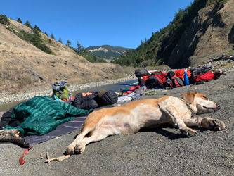
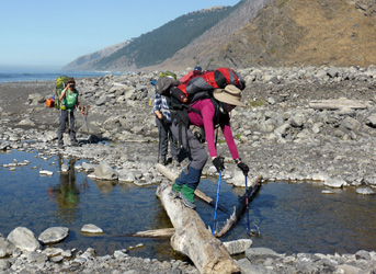
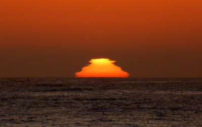
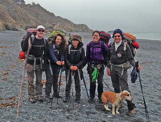
The trip was planned by Isa and is her annual tradition to plan outdoors adventures. Her friends are Devin, Mary, Jessica, and I was invited to join. A four-legged dog made her long distance hiking debut and succeeded well. On Thursday, 10/11, I carpooled the ladies from the Bay Area to Shelter Cove where we had reserved a van with driver to take us to the northern terminal at Mattole Beach. There we met Devin who came down from Seattle. At about 4 pm we were ready to head out for the adventure. The first impassible section was short and no problem due to good timing with the low tide at 8pm. In fact we could also get into the next 4 mi long impassible region and make camp at Sea Lion Creek before darkness. It was a foggy day, but at sunset the red sun appeared between the fog bank and the sea. During the hike we saw a herd of sea lions on the shore, more on islands, the Punta Gorda light house and a broken farm house. We camped beyond the reach of the high tide and had a good rest.
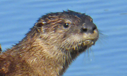
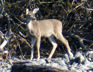
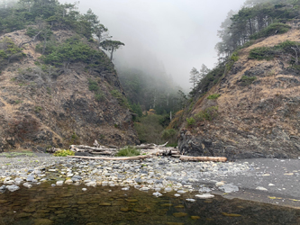
On Friday, 10/12, the window for hiking out of the impassable zone was from 6-10am. We had a late start and got stuck at Cooskie Creek and to wait for the next low tide, 5pm-midnight. Since it was a sunny day and a pretty place we did not mind the easy pace. The creek formed a lagoon, the home of a family of otters. A heron cruised over us. We napped in the sunshine, had an early dinner, and took off at 4:30pm. We made it safely out of the 4 mi impassable region and reached the pretty Spanish Flats where we set up camp on the bluffs. Timone chased the deer in the meadows, of course hopeless to catch up with them.
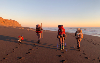
On sunny Saturday, 10/13, we started again at 8am on an easy high trail on the bluffs, resupplied water at the frequent creeks, passed by several private properties with nice homes and a landing strip for small planes. The high trail north of Miller Flats offered a wonderful view over the ocean. The window of hiking the next impassible zone was from 6pm to 1am. This implied a late hike into the darkness. We met others who were stuck and waited out for lower water levels. The crux was a rocky shore without sandy beach, which required rock climbing and good timing to avoid a cold shower from big waves. We decided that the dog would not like this, hence waited longer. We cooked dinner and saw a wonderful sunset. But time was flying away and I got a bit nervous about the potential night hike. Of course we could not make the whole 4 mi stretch but found an acceptable gulch at Shipman Creek. The camping was tight but well above the high tide line. We had a peaceful night except for the crashing waves nearby.
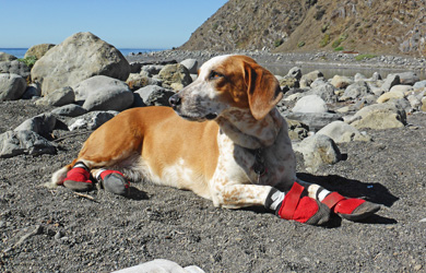
In the morning of Sunday, 10/14, we were fogged in. I had suggested to get up at 6am and hike out at 8am. We had to make the 2.5 mi long impassible section in a window of 1.5 hours window of low tide at 9am, a tight fit. I explained it to the group that we have to keep walking or we loose another day. This time reality set in and we passed Buck Creek and Gitchell Creek and were home free. Of course there were nearly 4 more miles of boulder and sand hiking to reach the end of the 24 mi journey. Timone started to limp, everyone was longing for solid ground, but we made it to Black Sand Beach by about 1pm. We were greeted by friends with a cute little dog, had a ceremony for Isa's late sister Ana, bid farewell to Devin who got a ride to Mattole to fetch his car and drive to Seattle. We stopped in Shelter Cove for lunch and then drove with my subi to the Bay Area.
We all had a feeling that this was a challenging hike, a great adventure to remember, a wonderful group of friends, luckily nobody got hurt, an admirable effort for those in the group with health issues, and Timone coping with her tight red shoes. Thanks to all and let's do another trip next year.
P.S. Pictures are taken by Jessica and Reiner.
|
|

|
|
|
|
|
|
|
|
|
|
|
|
|
|
|
|
|
Back to Trip Reports
Back to SMS Home Page